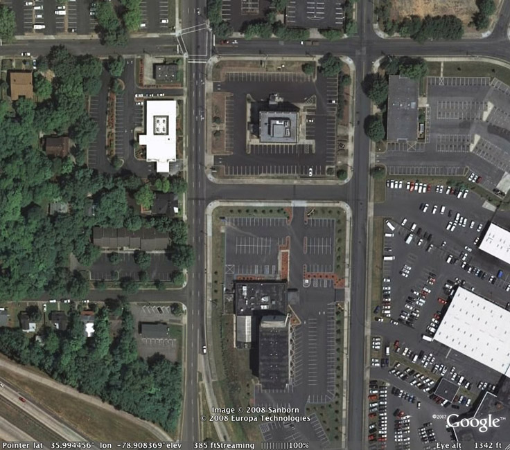
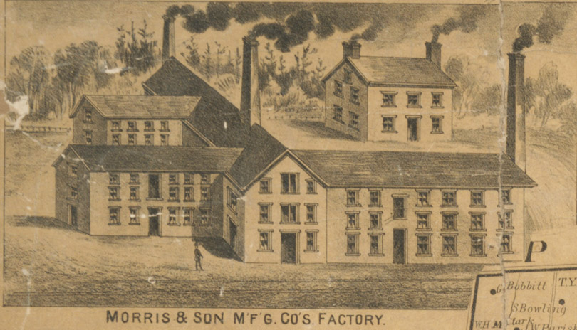
![]()
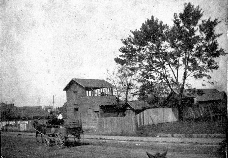
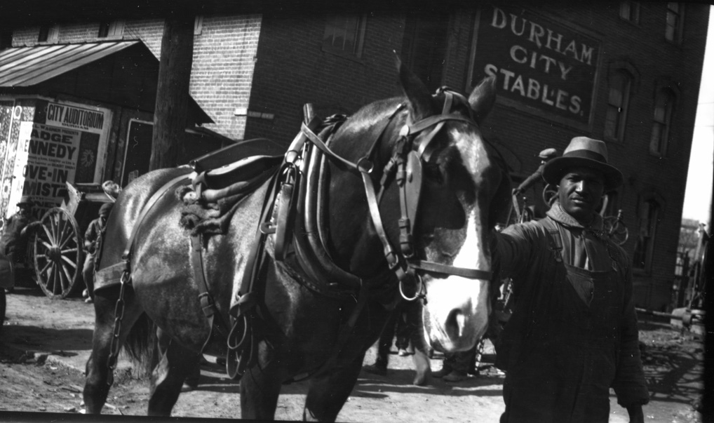
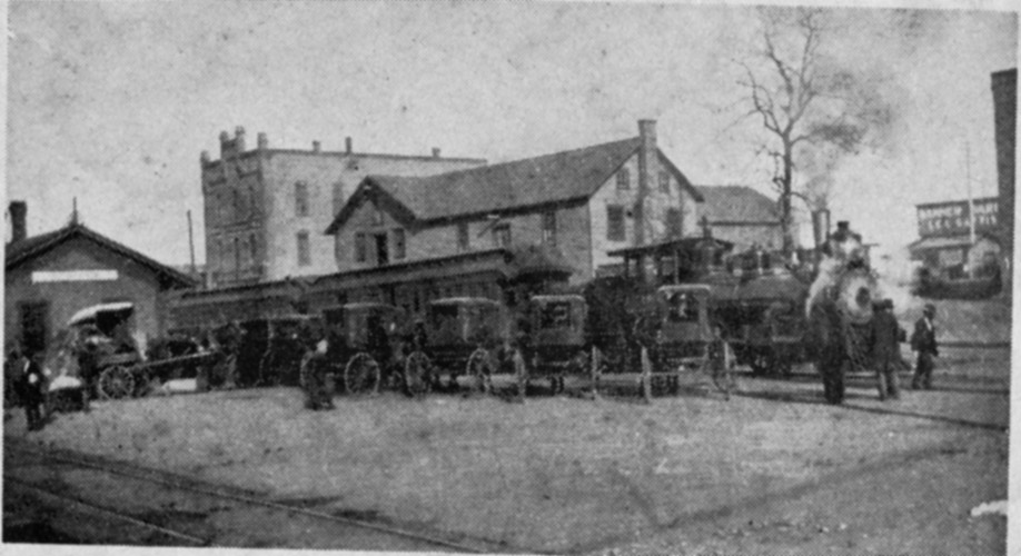
RF Morris Tobacco Factory at the NC railroad tracks ~300 feet west of present-day Corcoran St., 1890
(Courtesy Digital Durham.
The history of Robert Morris and his endeavors in the tobacco trade are an interesting, if patchwork, story about the earliest days of Durham. Per Jean Anderson:
"Morris first appeared on Orange County scene .... in Hillsborough, where he owned a variety store in 1847. The same year, he was granted a license to retail liquor at the Hillsborough House, the old Faddis' Tavern of the 18th century. In 1848 he was licensed to 'hawk and peddle' goods in Orange County. In 1850, then 36 years old, he was the hotel keeper of the Hillsborough House. He bought his first property for 10 dollars at a sheriff sale in 1851: 200 acres of William Copley's land near the Pin Hook area. Sometime in the early 1850s, recognizing the opportunity for his services in Durham, he moved to the tract of land that Andrew Turner had owned and took his chances running a hotel there."
Boyd reports that in 1858, Morris moved to Durham and open the town's first hotel.
"In 1858, Robert F. Morris moved 'to the hamlet and with his sons opened a factory in a small house that stood somewhere on the land now occupied by the Bull Factory. These were the pioneer tobacconists of Durham. Soon they took a partner, [Wesley] A. Wright of Virginia, and the firm name of Morris and Wright appeared. Mr. Wright invented a name for the product - 'Best Flavored Spanish Smoking Tobacco' .... In 1861, [Wright] withdrew from the enterprise, manufactured tobacco independently for a time on the farm of John Barbee, just east of Durham and in 1861 joined the Confederate Army. Dr. Richard Blacknall then became Morris' partner. About 1862 Morris and Blacknall sold out to John Ruffin Green, who had recently moved to Durham from Person County."
It appears that it is more likely that RF Morris' son, Thomas B. Morris, was the active partner with Wesley Wright - at least per later litigation over the use of the "Genuine Durham" trademark. Green, of course, would go on to partner with WT Blackwell, and that company would become Blackwell's Bull Durham. Morris grew at least a portion of the tobacco himself; in 1860, Morris grew 12,000 lbs. of tobacco. That same year, he donated an acre of land where the (the original) First Baptist Church stood.
By the 1860s, it appears that Morris owned land and buildings that had belonged to Bartlett Durham - the fact that he owned a hotel with an annex called "Pandora's Box" on the same site as Durham's home suggests that he may have turned the house into a hotel.
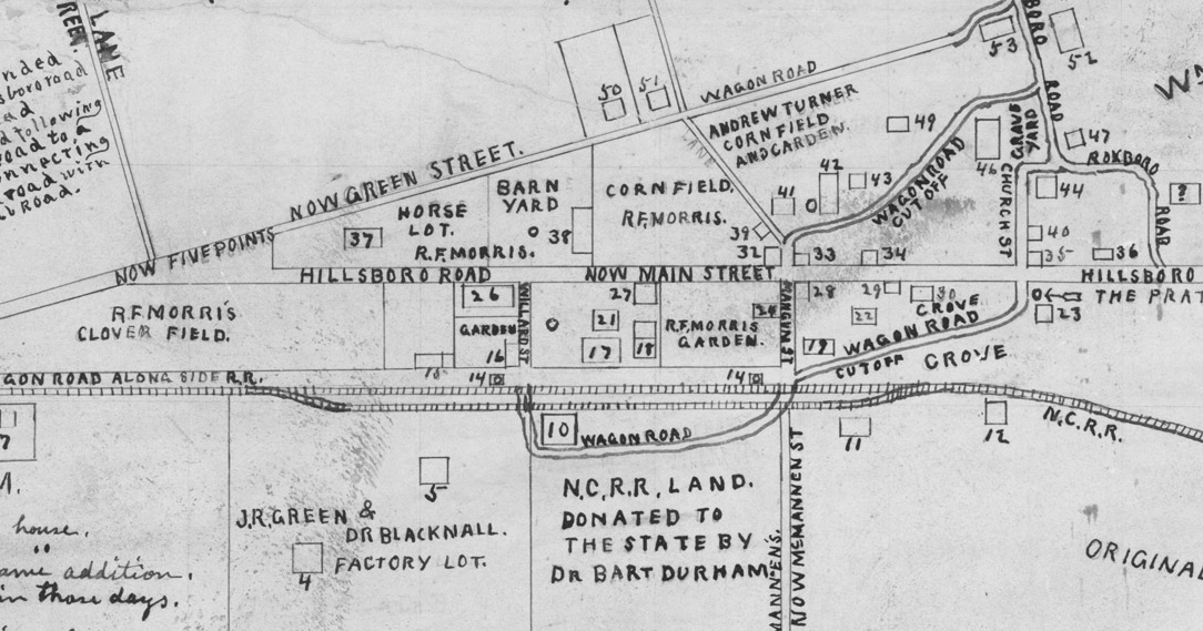
![]()
1865 map of Durham drawn in 1923 (Courtesy Digital Durham) - I've reproduced the legend numbers pertinent to Morris below as they appear on the map:
"7: One acre tract with log cabin given to George Bradshaw and his wife by RF Morris (Negroes)"
"15: Tobacco factory of RF Morris & Son (frame)"
"17: RF Morris Home and Hotel (frame)"
"18: Double, log kitchen to hotel. (logs)"
"21: Annex to hotel. Known as "Pandora's Box" 4 rooms & attic (Logs)"
"26: Dwelling occupied by JW Cox, owned by RF Morris"
"27: Small frame house used by RF Morris as an office."
"37: Frame feed house in RF Morris horse lot"
"38: Barn & stable of RF Morris"
"39: Blacksmith Shop on RF Morris' land"
Upon returning from the Civil War, Morris had established a new tobacco factory, as noted above, on the north side of the railroad tracks - either in 1865 or 1867. The tobacco business and Durham would grow rapidly from that point onward.
"In 1865 there was only one factory [in Durham]; in 1869 there were four, and in 1872 there were 12. Of these, the oldest, next to the enterprise established by JR Green, was that of RF Morris and Son, who in 1867 resumed the manufacture of smoking tobacco in a factory on Peabody St. just west of Corcoran. The brand established was called 'Eureka' and it bore the legend 'Best Spanish Flavored.' In a few years the manufacture of snuff was added, and such is the origin of the famous 'Ladies Choice Scotch Snuff.'.....The town of Durham was formally establishing itself, too, and was beginning to respond to the new prosperity that demand for its tobacco was bringing. The town as it was then is very quickly described. The nucleus was still Robert Morris' clutch of frame buildings, hotel, and annex, double log kitchen, blacksmith shop, office, barn stable, and feed house on the tract now bounded by the railroad, Corcoran, Main and Mangum Sts..... Morris' tobacco business (reorganized in 1865) and Green's were providing the vital spark which kindled the recovery to come..."
In 1868, Morris was elected an Orange County Commissioner; in 1869 a Town Commissioner. In 1869, Morris paid the largest property tax assessment in Durham, $40.62. It is noted by Anderson that Morris owned significant tracts of Hayti, and sold many of the initial tracts to African-Americans after the Civil War. He is also mentioned as owner of the Maplewood Cemetery tract - his heirs sold it to Dempsey Henderson in 1873.
In 1872, after the death of Robert Morris, RF Morris and Sons was sold to WH Willard and SF Tomlinson who continued the business. In 1884, Hiram Paul had wrote these flowery phrases about Morris and his company:
"Mr. Morris entertained the idea that Durham was one day to be a large and flourishing town ; and, incited by this idea, he invested largely in real estate in the future Chicago of the South. In consequence of his real estate investments, he cramped his tobacco business, which was rapidly growing. There was nothing selfish in his nature, but he felt a great pride in seeing Durham grow and prosper. He was generous to all.
Mr. Morris did not live long enough to see his pre-conceived ideas of Durham's greatness fulfilled, as it has been within the past seven or eight years that she has made her greatest progress and developed into a young city and a great tobacco mart.
The R. F. Morris & Son Manufacturing Co., of which W. H. Willard is president, and S. F. Tomlinson, Secretary and Treasurer, are the successors of R. F. Morris & Son, and under their supervision the " Eureka Durham " has sustained its high reputation as a smoker, helping to give the smoking tobaccos of Durham a world-wide reputation.
Their brands continue to grow in favor and their business is annually on the increase. Besides the celebrated 'Eureka Durham' they manufacture the 'Bear' and 'Gold Leaf Durham' the latter being of a beautiful golden color and made from the very finest tobacco grown in North Carolina, and only in a certain locality of the State. This tobacco, like the ' Vuelta Abass,' is of extra fine quality and has a flavor peculiar to itself, which no other tobacco has.
This firm manufactures also a superior article of Scotch Snuff, equal to any brand on the market. The name of their brand is '' Ladies' Choice Scotch Snuff.' It is made from the very best North Carolina sun cured tobacco, being entirely free from adulterations and injurious drugs or chemicals. This is a comparatively new enterprise, but a growing one. This firm is one of the leading manufactures of the town."
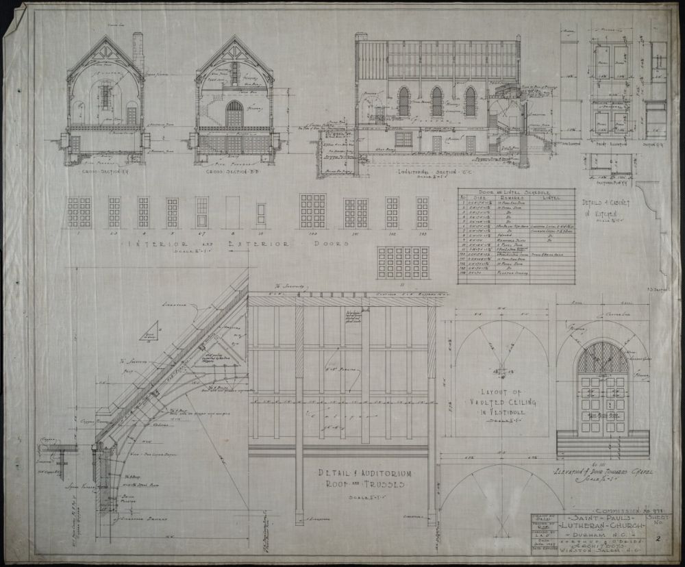
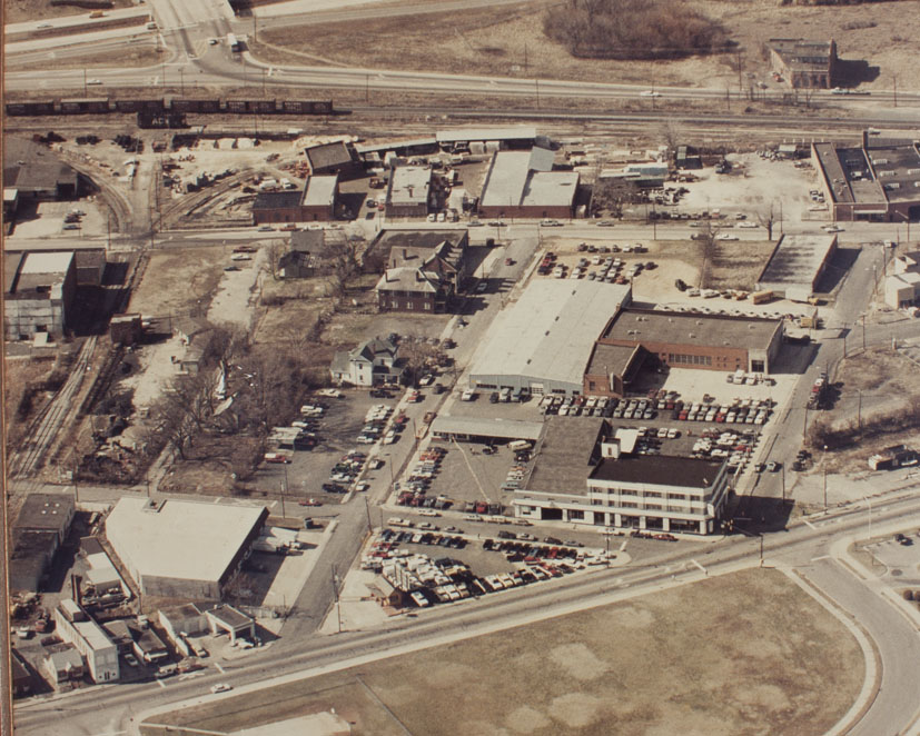
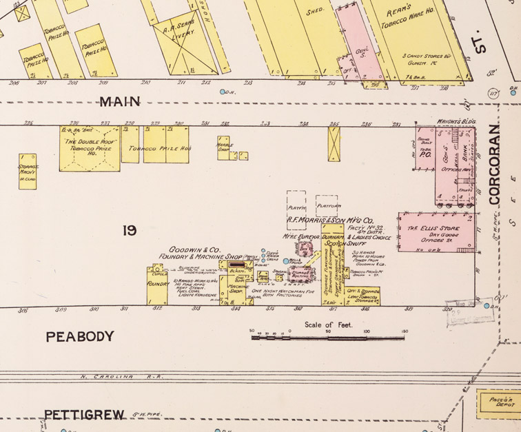
![]()
1888 Sanborn Map showing the frame RF Morris tobacco factory
(Courtesy Digital Durham)
In the early 1890s the company built a distinctive masonry structure facing south towards the railroad tracks.
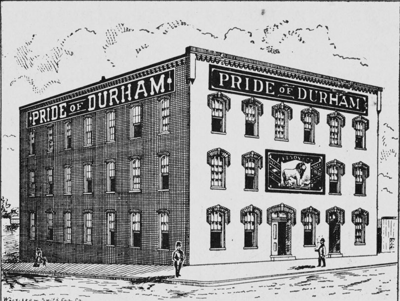
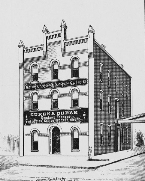
![]()
RF Morris Tobacco Factory, 1895, from the Handbook of Durham
(Courtesy Digital Durham)
As described in the Handbook of Durham:
"The factory is a three-story brick, with large two story frame building connected by a passage way from the second story of one to the second story of the other. Both of these structures are situated on Peabody St., immediately in the rear of the 'Southern' passenger depot. This concern manufactures a number of popular brands of smoking tobacco and snuff, among which is the celebrated 'Eureka Durham,' one of the finest brands of granulated tobacco known to the trade. As snuff manufacturers, they have no superior competitors, and find ready sales for all the goods they can put up.
The three floors of the brick building are employed as various departments for granulating, packing and stamping, while their frame building is used as departments for snuff grinding and storage of the natural leaf.
WH WIllard, the president, is connected with various manufacturing and banking institutions throughout the state, either as an officer or director. Is president of the Morehead Banking Company of this place. Mr. SF Tomlinson, the secretary and treasurer, has the management of these works, and has succeeded in creating a business that is well known to the trade"
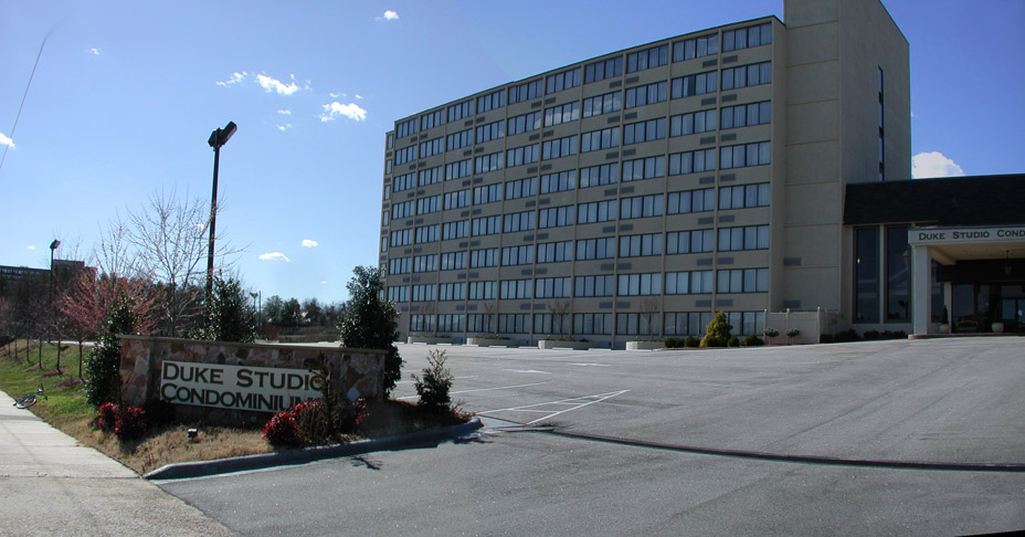
![]()
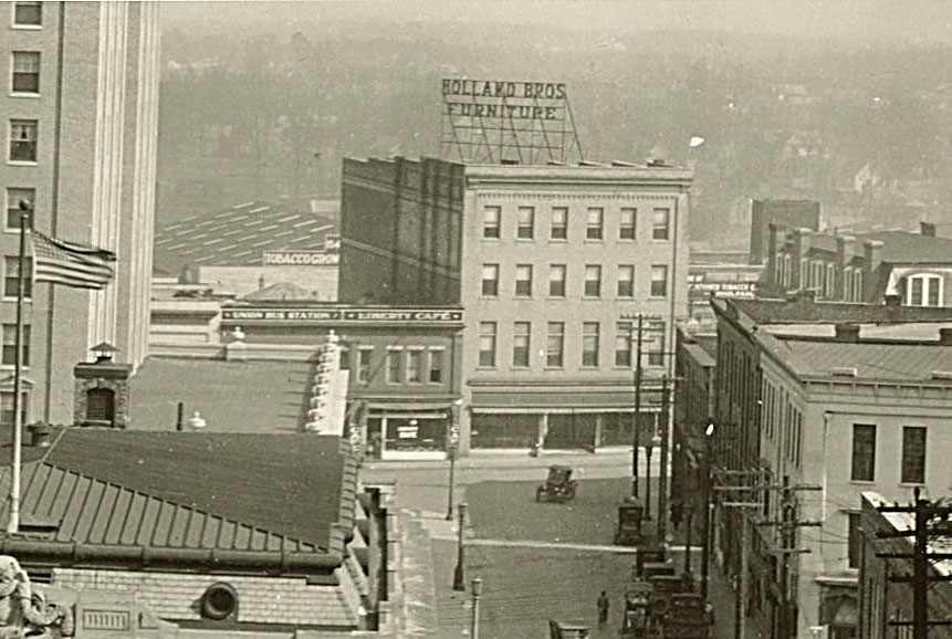
Looking northwest from Corcoran St., 1900. The original frame structure is in the right foreground, and the newer masonry structure in the background. The Southern Railway passenger depot is to the left.
(Courtesy Duke Rare Book and Manuscript Collection - Wyatt Dixon Collection)
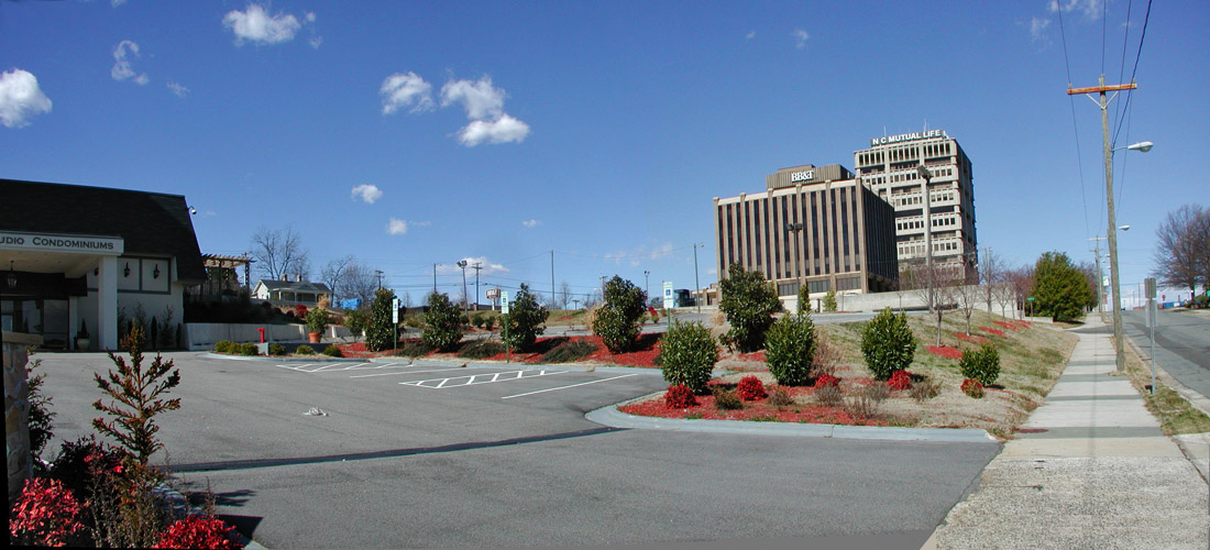
![]()
Looking west-northwest from Corcoran St. at the Southern Passenger Depot, with the RF Morris tobacco company in the background.
(Courtesy Duke Rare Book and Manuscript Collection - Wyatt Dixon Collection)
![]()
1902 Sanborn Map
(Courtesy Digital Durham.
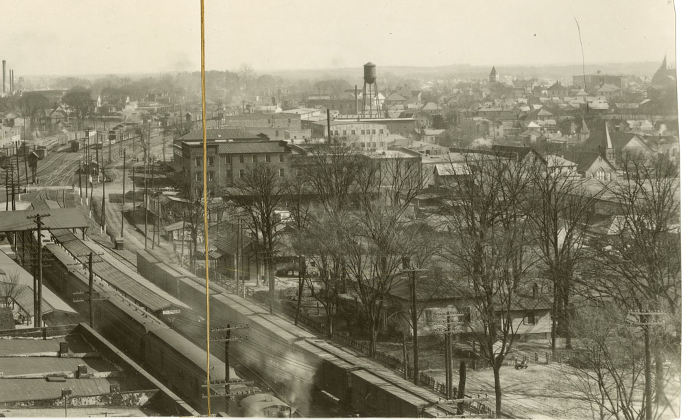
Tomlinson and Willard continued to business until 1903, when they sold it to the American Tobacco Company. Sometime between 1903 and 1906, the factory was torn down, and the Seaboard Airline RR built a freight depot in its place. The SAL freight depot was long, low brick structure extending along the northern side of the railroad tracks in the vicinity of the current surface parking lot behind structures in the 200 and 300 blocks of West Main St.
![]()
(Courtesy Duke Rare Book and Manuscript Collection - Wyatt Dixon Collection)
This was the site of the city's first major attempt to deal with its parking problem in 1957 - by demolishing the freight depot and converting all of the space between the railroad tracks and the backs of the buildings on West Main St. into surface parking.
![]()
Partly demolished SAL Freight Depot, looking southwest from around Corcoran.
(Courtesy Duke Rare Book and Manuscript Collection - Wyatt Dixon Collection)
![]()
Fully Demolished depot and 100 block of South Corcoran.
(Courtesy Duke Rare Book and Manuscript Collection - Wyatt Dixon Collection)
![]()
Early use of the parking lot, looking southwest, 06.25.57
Courtesy of The Herald-Sun Newspaper
![]()
Early use of the parking lot, looking west, 06.25.57
Courtesy of The Herald-Sun Newspaper
The lot was soon paved and striped. Businesses on West Main St. began to convert their rear entrances into primary entrances to face the parking lot.
![]()
Looking west from the Silk Hosiery Mill, 1957.
Courtesy of The Herald-Sun Newspaper
![]()
Looking east from near West Chapel Hill St., 10.12.57
Courtesy of The Herald-Sun Newspaper
![]()
Looking north from Corcoran and the railroad tracks.
(Courtesy Durham County Library)
By the early 1960s, Durham decided to build its first parking garage at the east end of this parking lot, abutting Corcoran St. Buildings at the east end of the lot were demolished to create an entry to the parking lot and garage from the east. A pedestrian 'mall' and entryway to the garage were created where there was once a short street
![]()
Building the pedestrian mall entrance, 10.29.64
Courtesy of The Herald-Sun Newspaper
![]()
Parking garage under construction, 10.29.64
Courtesy of The Herald-Sun Newspaper
![]()
Looking north from Corcoran and the railroad tracks.
(Courtesy Durham County Library)
![]()
The completed product, looking northwest from the railroad tracks.
(Courtesy Durham County Library)
In 1969-1970, a roadway was created from the parking lot entry running along the north side of the railroad tracks, south of the parking deck, and connecting east with Roxboro and Ramseur St. - the Loop.
As for the parking deck, it hasn't changed much.
![]()
Looking northwest from Corcoran and Ramseur, 2007.
(Photo by Gary Kueber)
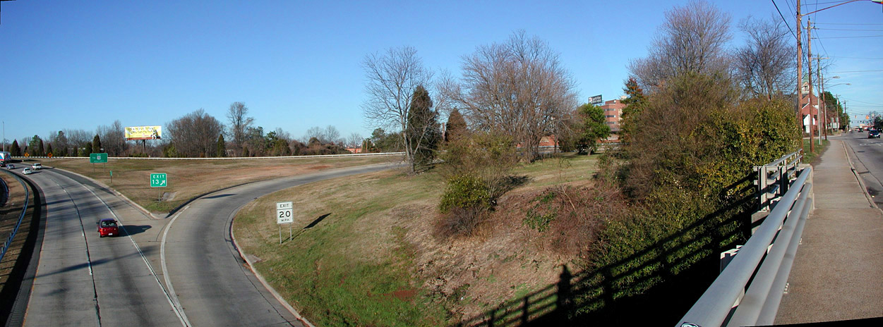
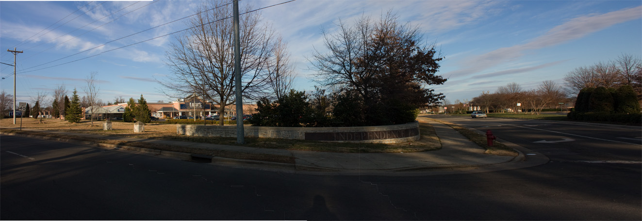
![]()
The approximate site of the RF Morris Tobacco Factory, 06.13.10
(Photo by Gary Kueber)


.jpg)


.JPG)